METAR & TAF 76A
76A does not publish a METAR.
Showing the nearest reporting station: KBVX (BATESVILLE RGNL) · 25.8 NM away. Conditions at 76A may differ.
METAR · KBVX
Observed 21:56Z
KBVX 262156Z AUTO 11006KT 10SM CLR 38/26 A2992 RMK AO2 SLP127 T03780256 $
- Wind
- 110° @ 6 kt
- Visibility
- 10 SM
- Temp / Dew
- 38°C / 26°C
- Altimeter
- 29.92 inHg
- Clouds
- CLR
- Density alt
- 3,027 ft
- Ceiling
- Unlimited
- Rules
- VFR
Airport info & contacts
Manager on record, flight service, ARTCC, attendance schedule and pattern altitude — published by the FAA and refreshed every 28 days.
Location
- From city
- 1 NM S
- VFR sectional
- MEMPHIS
- ARTCC
- ZME · MEMPHIS
- NOTAM facility
- JBR (NOTAM-D)
Airport manager
- Name
- MARK ELLIS
- Phone
- 870-217-1865
- Address
- 6550 HWY 17 SOUTH, NEWPORT AR 72112
Flight service · Hours
- FSS JBR
- JONESBORO1-800-WX-BRIEF
Frequencies
Tap any row to copy the frequency to your clipboard.
Runways & pattern
Full pagePattern entry · RWY 18
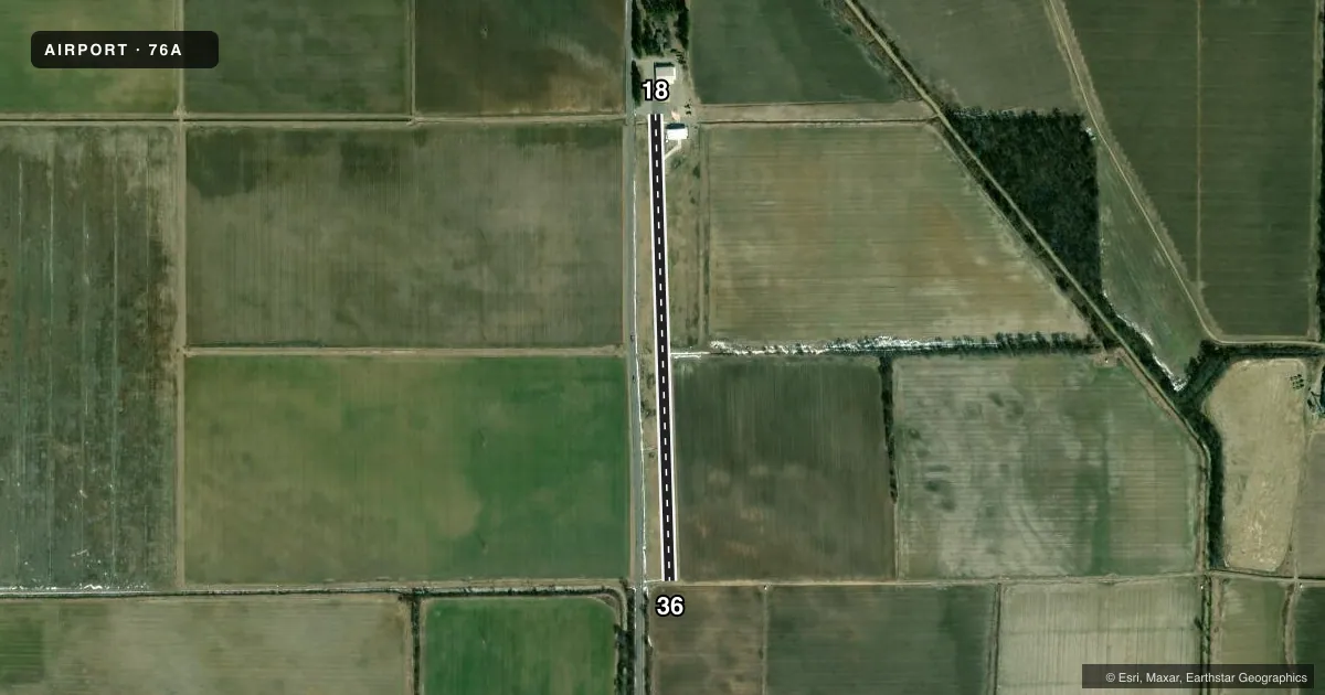
LEFT TRAFFICAirport sketch
Runways drawn to scale from FAA survey coordinates, rendered over satellite imagery. Not for navigation.
Approaches & charts
Services on the field
Fuel grades, oxygen, maintenance, ramp storage and lighting — as declared to the FAA by the airport operator.
Fuel & services
- Fuel
- Not available
Ramp & ground
- Transient storage
- Not published
Fuel & FBOs
Cheapest 100LL and Jet A on the field and nearby. Always confirm with the FBO before taxi.
Airport notes
Surface conditions, obstructions, local procedures, lighting outages and other notes published with each FAA cycle.
VFR map & nearby airports
VFR sectional. Tap any ICAO chip to open that airport.
Key facts · 76A
Answer card- ICAO
- 76A
- Name
- EFS
- Location
- SHOFFNER, ARKANSAS
- Elevation
- 215 ft MSL
- Traffic pattern altitude
- 1,215 ft MSL (1,000 AGL)
- Control tower
- Non-towered (use CTAF)
- Total runways
- 1
- Longest runway
- 18/36 · 2,695 ft
- Published ILS approaches
- 0
- Published frequencies
- 0
- Magnetic variation
- –
- Current flight rules
- VFR
- Current wind
- 110° at 6 kt
- Favored runway now
- RWY 18
EFS sits near Shoffner, Arkansas. Field elevation is 215 ft MSL. This is a small nontowered airport with one runway. Runway 18/36 is 2,695 ft long with asphalt and gravel surface. That length works for light piston traffic. It is not a place to plan around extra margin without checking your own performance numbers.
No ILS approaches are published here. Pattern altitude is not published, so use the current FAA Chart Supplement before you go. The airport has no listed on-field FBOs. Contact the airport operator directly before arrival. Call the field on CTAF or UNICOM for current fuel and service availability. No frequencies were provided in the facts block.
For a first-time stop, the main things to verify are runway condition, traffic pattern details and any local procedures that may not be obvious from the chart alone. The runway headings are magnetic. Magnetic variation is not provided in the facts. If you are planning a night or marginal-weather arrival, confirm current airport status and available services before launch.