METAR & TAF P19
P19 does not publish a METAR.
Showing the nearest reporting station: KCHD (CHANDLER MUNI) · 5.5 NM away. Conditions at P19 may differ.
METAR · KCHD
Observed 12:35Z
KCHD 271235Z AUTO 03005KT 10SM CLR 27/05 A2983 RMK AO2 T02750051
- Wind
- 030° @ 5 kt
- Visibility
- 10 SM
- Temp / Dew
- 27°C / 5°C
- Altimeter
- 29.83 inHg
- Clouds
- CLR
- Density alt
- 3,013 ft
- Ceiling
- Unlimited
- Rules
- VFR
Airport info & contacts
Manager on record, flight service, ARTCC, attendance schedule and pattern altitude — published by the FAA and refreshed every 28 days.
Location
- From city
- 3 NM W
- VFR sectional
- PHOENIX
- Pattern altitude
- 823 ft AGL · 2,002 ft MSL
- ARTCC
- ZAB · ALBUQUERQUE
- NOTAM facility
- PRC (NOTAM-D)
Airport manager
- Name
- BOARD OF DIRECTORS
- Phone
- 480-359-6575
- Address
- 11 NORTH STELLAR PARKWAY, CHANDLER AZ 85226-3715
Flight service · Hours
- FSS PRC
- PRESCOTT1-800-WX-BRIEF
- Attendance
- Unattended
Frequencies
Tap any row to copy the frequency to your clipboard.
Runways & pattern
Full pagePattern entry · RWY 35
LEFT TRAFFICRunway end performance
| End | TORA | TODA | ASDA | LDA | VGSI | Approach lights | Obstruction |
|---|---|---|---|---|---|---|---|
| 17 | — | — | — | 4,051' | PAPI 2-box left(3.25°) | — | 15', road, 201' from thr, 0' R of cntrln, slope 0 |
| 35 | — | — | — | 4,068' | PAPI 2-box right(3.25°) | — | 11', tree, 216' from thr, 10' R of cntrln, slope 1 |
Declared distances in feet. TORA = takeoff run available, TODA = takeoff distance, ASDA = accelerate-stop, LDA = landing distance.
Airport sketch
Runways drawn to scale from FAA survey coordinates, rendered over satellite imagery. Not for navigation.
Approaches & charts
Services on the field
Fuel grades, oxygen, maintenance, ramp storage and lighting — as declared to the FAA by the airport operator.
Fuel & services
- Fuel
- 100LLA
- Airframe repair
- Minor
- Power plant repair
- Minor
Ramp & ground
- Transient storage
- Not published
- Landing fee
- No fee published
- Customs
- Not available
- Lighting schedule
- SEE RMK
- Beacon schedule
- SS-SR
- Beacon
- White / Green (civil land)(WG)
- Wind indicator
- Yes
- Segmented circle
- No
Fuel & FBOs
Cheapest 100LL and Jet A on the field and nearby. Always confirm with the FBO before taxi.
Airport notes
Surface conditions, obstructions, local procedures, lighting outages and other notes published with each FAA cycle.
General notes
- ALERT: NON RADIO ACFT & BIRDS ON & INVOF ARPT.
- TRNG TGL & TRNG HEL NA.
- AVOID OTFC OF NOISE SENS AREA W OF RWY 17/35 & N OF ARPT.
- COML & STUDENT TRNG OPS PMT ONLY.
- FLOOD IRRIGATION BTW RWY & TWY; WATER UP TO 1 FT IREG SKED.
- ENG RUNUP USE E SIDE AREA.
- TSNT CRTFYD FOR 15000 GROSS TKOF WEIGHT PPR.
- FOR CD CTC PHOENIX APCH AT 602-306-2565.
Lighting notes
- DUSK-DAWN: ACTVT REIL RWY 17 & 35; MIRL RWY 17/35 - CTAF.
Fuel notes
- 100LLSELF SVC H24; INFO 623-277-0000.
- APPR - 602-750-2226.
Runway surface & condition
- 17/35RWY 17 CALM WIND RWY.
Approach & departure obstructions
- 17+8 FT FENCE 130 FT FM RWY END; +15 FT ROAD 164 FT FM RWY END ACRS THR.
- 35+6 FT FENCE 80 FT FM RWY END ACRS THR; +15 FT ROAD 85 FT FM RWY END ACRS THR.
- 1750:1 SLOPE TO DTHR; 11 FT TREE 565 FT FM DTHR 10 FT L OF CNTRLN.
- 35APCH SLOPE 22:1 TO DTHR.
Other notes
- TFC PAT TO W OF ARPT.
- MANAGERAVBL TO ALL 7 MEMBER BOARD.
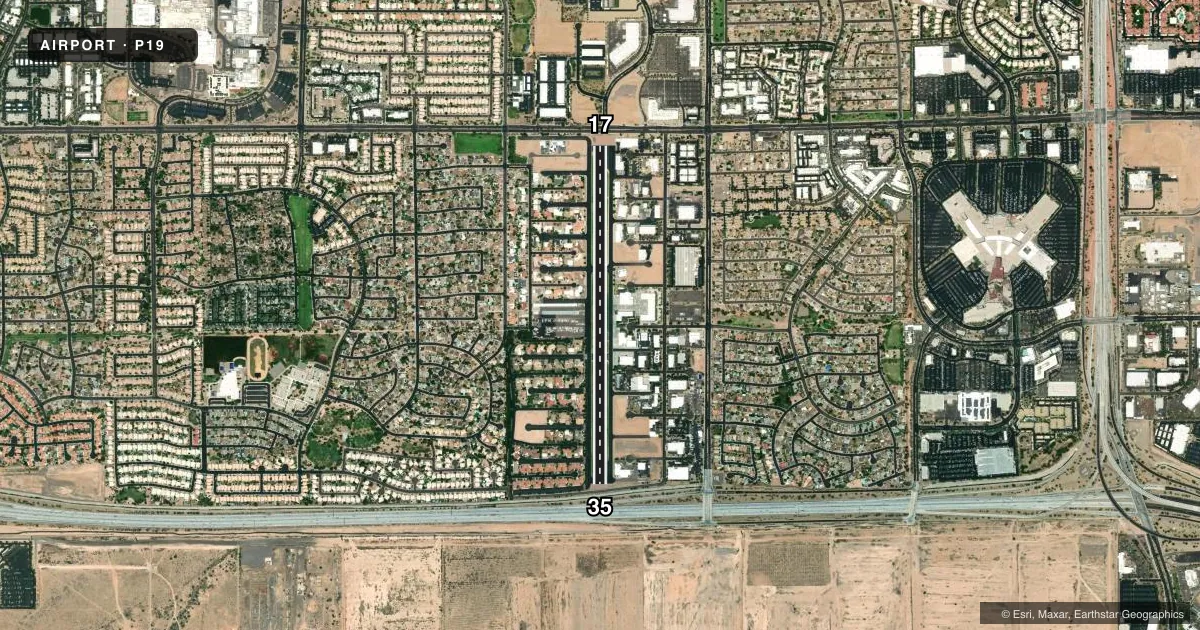
VFR map & nearby airports
VFR sectional. Tap any ICAO chip to open that airport.
Key facts · P19
Answer card- ICAO
- P19
- Name
- STELLAR AIRPARK
- Location
- CHANDLER, ARIZONA
- Elevation
- 1,178.5 ft MSL
- Traffic pattern altitude
- 2,001.5 ft MSL (823 AGL)
- Control tower
- Non-towered (use CTAF)
- Total runways
- 1
- Longest runway
- 17/35 · 4,417 ft
- Published ILS approaches
- 0
- Published frequencies
- 4
- Magnetic variation
- 9°
- Current flight rules
- VFR
- Current wind
- 030° at 5 kt
- Favored runway now
- RWY 35
STELLAR AIRPARK is in Chandler, Arizona. The field elevation is 1,178.5 ft MSL. It has one runway, 17/35, which is 4,417 ft long. There is no control tower. CTAF and UNICOM are both 122.975. Phoenix approach and departure are on 123.7 and 363.0.
No ILS approaches are published here. Pattern altitude is 823 ft AGL, which is 2,001.5 ft MSL. Traffic pattern is to the west of the airport. Runway 17 is the calm wind runway. Published remarks also say non-radio aircraft and birds are on and near the airport. Training touch-and-go and training helicopter operations are not authorized. Commercial and student training operations are permitted only.
There are no on-field FBOs listed in the facts, so call the airport operator or the field directly before arrival for current services. The published remarks also flag runway-end obstructions near both thresholds. Runway 17 has an 8-foot fence and a road near the end. Runway 35 has a 6-foot fence and a road near the end. Avoid the noise-sensitive area west of runway 17/35 and north of the airport. Transient aircraft over 15,000 lb gross takeoff weight need prior permission. For a first-time arrival, review the current Chart Supplement and plan for a busy training-focused field with west-side pattern traffic.