METAR & TAF KASJ
Current METAR
Observed 15:35Z
KASJ 261535Z AUTO 01005KT 10SM BKN027 25/18 RMK AO2 T02450183
- Wind
- 010° @ 5 kt
- Visibility
- 10 SM
- Temp / Dew
- 25°C / 18°C
- Altimeter
- —
- Clouds
- BKN
- Density alt
- 1,283 ft
- Ceiling
- 2,700 ft AGL
- Rules
- MVFR
Airport info & contacts
Manager on record, flight service, ARTCC, attendance schedule and pattern altitude — published by the FAA and refreshed every 28 days.
Location
- From city
- 9 NM W
- VFR sectional
- WASHINGTON
- ARTCC
- ZDC · WASHINGTON
- NOTAM facility
- ASJ (NOTAM-D)
Airport manager
- Name
- HENRY JOYNER
- Phone
- 252-345-0111
- Address
- 140 TRI-COUNTY AIRPORT RD, AULANDER NC 27805
Flight service · Hours
- FSS RDU
- RALEIGH1-800-WX-BRIEF
- Attendance
- MON-SAT · 0900-DUSK
- SUN · Unattended
Frequencies
Tap any row to copy the frequency to your clipboard.
Runways & pattern
Full pagePattern entry · RWY 01
LEFT TRAFFICRunway end performance
| End | TORA | TODA | ASDA | LDA | VGSI | Approach lights | Obstruction |
|---|---|---|---|---|---|---|---|
| 01 | — | — | — | — | PAPI 2-box left(3.17°) | — | 10', road, 422' from thr, 0' R of cntrln, slope 22 |
| 19 | — | — | — | — | PAPI 2-box left(3°) | — | 71', trees, 973' from thr, 292' R of cntrln, slope 10 |
Declared distances in feet. TORA = takeoff run available, TODA = takeoff distance, ASDA = accelerate-stop, LDA = landing distance.
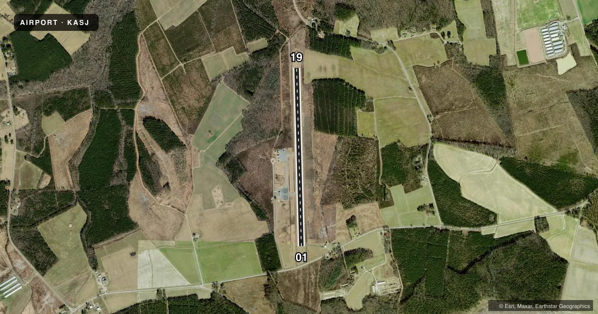
Airport sketch
Runways drawn to scale from FAA survey coordinates, rendered over satellite imagery. Not for navigation.
Approaches & charts
Services on the field
Fuel grades, oxygen, maintenance, ramp storage and lighting — as declared to the FAA by the airport operator.
Fuel & services
- Fuel
- 100LLA1+
- Oxygen (bottled)
- Not available
- Oxygen (bulk)
- Not available
- Airframe repair
- Not available
- Power plant repair
- Not available
- Other services
- INSTR,RNTL
Ramp & ground
- Transient storage
- Tie-down
- Landing fee
- No fee published
- Customs
- Not available
- Lighting schedule
- SEE RMK
- Beacon schedule
- SS-SR
- Beacon
- White / Green (civil land)(WG)
- Wind indicator
- Lighted
- Segmented circle
- Yes
Fuel & FBOs
Cheapest 100LL and Jet A on the field and nearby. Always confirm with the FBO before taxi.
Airport notes
Surface conditions, obstructions, local procedures, lighting outages and other notes published with each FAA cycle.
General notes
- RWY 01/19 -4 FT DITCH 120 FT L & R OF CNTRLN.
- FOR CD CTC WASHINGTON ARTCC AT 703-771-3587.
Lighting notes
- ACTVT REIL RWY 01 & 19; MIRL RWY 01/19 - CTAF. PAPI RWY 01 & 19 OPER CONSLY.
Fuel notes
- 100LL100LL AND JET A - 24 HR SELF SERVICE AVBL WITH CREDIT CARD.
Other notes
- MANAGERFOR ARPT AMGR AFTER HOURS CALL 252-395-0822.
VFR map & nearby airports
VFR sectional. Tap any ICAO chip to open that airport.
Key facts · KASJ
Answer card- ICAO
- KASJ
- Name
- TRI-COUNTY AT HENRY JOYNER FLD
- Location
- AHOSKIE, NORTH CAROLINA
- Elevation
- 66.6 ft MSL
- Traffic pattern altitude
- 1,066.6 ft MSL (1,000 AGL)
- Control tower
- Non-towered (use CTAF)
- Total runways
- 1
- Longest runway
- 01/19 · 4,501 ft
- Published ILS approaches
- 0
- Published frequencies
- 2
- Magnetic variation
- 10°
- Current flight rules
- MVFR
- Current wind
- 010° at 5 kt
- Favored runway now
- RWY 01
Tri-County at Henry Joyner Fld sits in Ahoskie, North Carolina. Field elevation is 66.6 ft MSL. The airport has one runway, 01/19, which is 4,501 ft long and paved with asphalt. There is no control tower. CTAF and UNICOM are both 122.8. No ILS approaches are published here.
The published pattern altitude is not listed, so use the standard 1,000 ft AGL for light piston operations unless the current FAA Chart Supplement says otherwise. The field is close to sea level. Density altitude is usually less of a factor than at higher airports. Summer heat can still matter. Runway 01 and 19 have REIL lighting. Medium intensity runway lights are available on runway 01/19 and are controlled by CTAF. PAPI on both ends operates continuously.
Tri-County Airport is the on-field FBO. It carries AVGAS 100LL. Published remarks also say 100LL and Jet A are available 24 hours by self-service with credit card. One operational note stands out. There is a 4-foot ditch 120 feet left and right of the runway 01/19 centerline. For after-hours airport manager contact, use the number in the current Chart Supplement or call the airport operator directly before arrival.