METAR & TAF PAUT
Current METAR
Observed 14:55Z
PAUT 261455Z AUTO 29029G38KT 10SM OVC011 10/09 A3022 RMK AO2 PK WND 30038/1446 SLP196 P0001 60001 T01000094 50000 FZRANO $
- Wind
- 290° @ 29G38 kt
- Visibility
- 10 SM
- Temp / Dew
- 10°C / 9°C
- Altimeter
- 30.22 inHg
- Clouds
- OVC
- Density alt
- -812 ft
- Ceiling
- 1,100 ft AGL
- Rules
- MVFR
Airport info & contacts
Manager on record, flight service, ARTCC, attendance schedule and pattern altitude — published by the FAA and refreshed every 28 days.
Location
- From city
- 6 NM E
- VFR sectional
- DUTCH HARBOR
- ARTCC
- ZAN · ANCHORAGE
- NOTAM facility
- 7AK (NOTAM-D)
Airport manager
- Name
- CHRIS TAPAOAN
- Phone
- 907-784-3476
- Address
- P.O. BOX 920525, DUTCH HARBOR AK 99692-0525
Flight service · Hours
- FSS CDB
- COLD BAY907-532-24661-800-478-7250
- Attendance
- 0700-1900
Frequencies
Tap any row to copy the frequency to your clipboard.
Runways & pattern
Full pagePattern entry · RWY 27
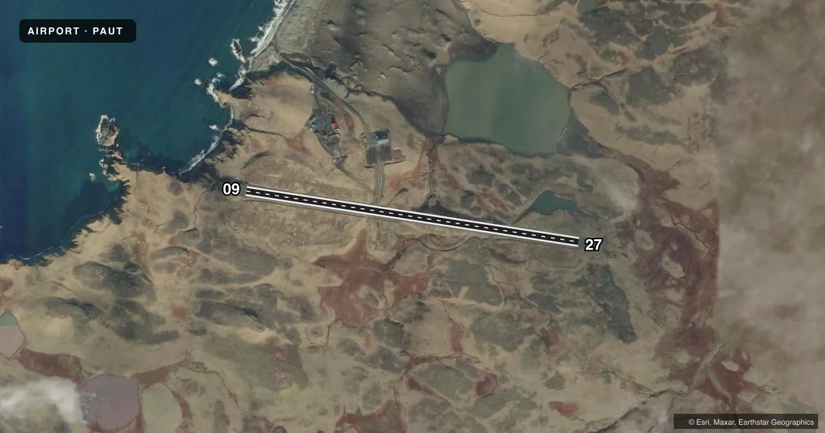
LEFT TRAFFICAirport sketch
Runways drawn to scale from FAA survey coordinates, rendered over satellite imagery. Not for navigation.
Approaches & charts
Services on the field
Fuel grades, oxygen, maintenance, ramp storage and lighting — as declared to the FAA by the airport operator.
Fuel & services
- Fuel
- Not available
Ramp & ground
- Transient storage
- Tie-down
- Lighting schedule
- SEE RMK
- Beacon schedule
- SS-SR
- Beacon
- White / Green (civil land)(WG)
- Wind indicator
- Lighted
- Segmented circle
- Yes
Fuel & FBOs
Cheapest 100LL and Jet A on the field and nearby. Always confirm with the FBO before taxi.
Airport notes
Surface conditions, obstructions, local procedures, lighting outages and other notes published with each FAA cycle.
General notes
- WX CAMERA AVBL ON INTERNET AT HTTPS://WEATHERCAMS.FAA.GOV
- GCO AVBL - 130.3; 5 CLICKS KENAI FSS; OCNL INOP.
- ARPT ON AKUN ISLAND; AKUTAN SHUTTLE AVBL.
Lighting notes
- ACTVT MIRL RWY 09/27 - CTAF.
Other notes
- MUST PROVIDE OWN ROPE.
VFR map & nearby airports
VFR sectional. Tap any ICAO chip to open that airport.
Key facts · PAUT
Answer card- ICAO
- PAUT
- Name
- AKUTAN
- Location
- AKUTAN, ALASKA
- Elevation
- 129.3 ft MSL
- Traffic pattern altitude
- 1,129.3 ft MSL (1,000 AGL)
- Control tower
- Non-towered (use CTAF)
- Total runways
- 1
- Longest runway
- 09/27 · 4,500 ft
- Published ILS approaches
- 0
- Published frequencies
- 1
- Magnetic variation
- 10°
- Current flight rules
- MVFR
- Current wind
- 290° at 29 kt
- Favored runway now
- RWY 27
Akutan Airport sits on Akun Island in Akutan, Alaska. Field elevation is 129.3 ft MSL. The airport has one runway. Runway 09/27 is 4,500 ft long with an asphalt surface. There is no control tower. CTAF is 122.9. Medium intensity runway lights on 09/27 are pilot-activated through the CTAF. No ILS approaches are published here.
The published pattern altitude is not listed, so use standard 1,000 ft AGL unless the current FAA Chart Supplement says otherwise. That puts the pattern at about 1,129 ft MSL based on the field elevation. The airport is on a small island setting, so plan for local weather and coastal conditions. A weather camera is available online for a quick look before departure. The charted remarks also say the airport is on Akun Island and that an Akutan shuttle is available. You must provide your own rope.
There are no on-field FBOs listed. Check with the airport operator or the FBO directly by phone before arrival if you need ground support or fuel details. A ground communications outlet is listed on 130.3. It is activated with five clicks to Kenai Flight Service Station, though it is occasionally inoperative. For any current operational notes, lighting details, or surface condition concerns, verify with the current FAA Chart Supplement before you go.