METAR & TAF PAAK
Current METAR
Observed 01:09Z
PAAK 270109Z AUTO 30010KT 10SM FEW012 20/18 A3046 RMK AO2 TSNO
- Wind
- 300° @ 10 kt
- Visibility
- 10 SM
- Temp / Dew
- 20°C / 18°C
- Altimeter
- 30.46 inHg
- Clouds
- FEW
- Density alt
- -1 ft
- Ceiling
- Unlimited
- Rules
- VFR
Airport info & contacts
Manager on record, flight service, ARTCC, attendance schedule and pattern altitude — published by the FAA and refreshed every 28 days.
Location
- From city
- 2 NM N
- VFR sectional
- W ALEUTIAN ISLS
- ARTCC
- ZAP · ANCHORAGE OCEANIC
- NOTAM facility
- AKA (NOTAM-D)
Airport manager
- Name
- DALE RUCKMAN
- Phone
- 907-581-1786
- Address
- PO BOX 920525, UNALASKA AK 99692-0525
Flight service · Hours
- FSS CDB
- COLD BAY907-532-24661-800-478-7250
- Attendance
- Unattended
Frequencies
Tap any row to copy the frequency to your clipboard.
Runways & pattern
Full pagePattern entry · RWY 34
LEFT TRAFFICRunway end performance
| End | TORA | TODA | ASDA | LDA | VGSI | Approach lights | Obstruction |
|---|---|---|---|---|---|---|---|
| 16 | — | — | — | — | — | — | 15', road, 813' from thr, 0' R of cntrln, slope 1 |
| 34 | — | — | — | — | — | — | 15', road, 200' from thr, 60' R of cntrln, slope 1 |
Declared distances in feet. TORA = takeoff run available, TODA = takeoff distance, ASDA = accelerate-stop, LDA = landing distance.
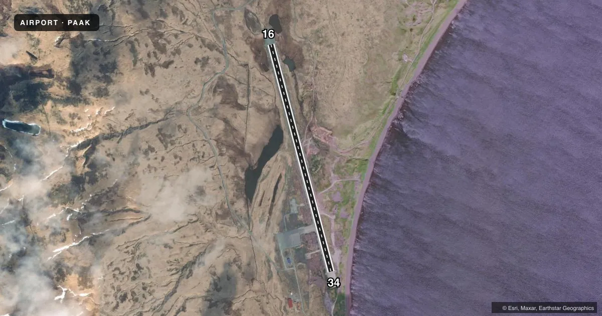
Airport sketch
Runways drawn to scale from FAA survey coordinates, rendered over satellite imagery. Not for navigation.
Approaches & charts
Services on the field
Fuel grades, oxygen, maintenance, ramp storage and lighting — as declared to the FAA by the airport operator.
Fuel & services
- Fuel
- Not available
Ramp & ground
- Transient storage
- Not published
- Landing fee
- No fee published
- Lighting schedule
- SS-SR
- Beacon schedule
- SS-SR
- Beacon
- White / Green (civil land)(WG)
- Wind indicator
- Lighted
- Segmented circle
- Yes
Fuel & FBOs
Cheapest 100LL and Jet A on the field and nearby. Always confirm with the FBO before taxi.
Airport notes
Surface conditions, obstructions, local procedures, lighting outages and other notes published with each FAA cycle.
General notes
- RWY COND NOT MNT; RCMD VISUAL INSP PRIOR TO USE.
- GULLS & EAGLES ALG NAZAN BAY SHORELINE.
- GCO AVBL ON FREQ 122.15 NSTD 4 CLICKS FOR KENAI FSS.
- RWY MAINT & SNOW REMOVAL - 907-839-2319.
- AUTO WX - CTAF 4 CLICKS.
Runway surface & condition
- 16/34WASH OUT E SIDE OUTSIDE OF LGTS.
Approach & departure obstructions
- 16SAFETY AREA 150 PAVED & 150 FT GRVL.
- 34SAFETY AREA 150 PAVED & 150 FT GRVL.
- 16WORN
- 34WORN
VFR map & nearby airports
VFR sectional. Tap any ICAO chip to open that airport.
Key facts · PAAK
Answer card- ICAO
- PAAK
- Name
- ATKA
- Location
- ATKA, ALASKA
- Elevation
- 55.2 ft MSL
- Traffic pattern altitude
- 1,055.2 ft MSL (1,000 AGL)
- Control tower
- Non-towered (use CTAF)
- Total runways
- 1
- Longest runway
- 16/34 · 4,500 ft
- Published ILS approaches
- 0
- Published frequencies
- 1
- Magnetic variation
- 8°
- Current flight rules
- VFR
- Current wind
- 300° at 10 kt
- Favored runway now
- RWY 34
ATKA is in Atka, Alaska. The field elevation is 55.2 ft MSL. It has one runway, 16/34, which is 4,500 ft long. There is no control tower. CTAF is 122.9. No ILS approaches are published here.
The pattern altitude is not published. Use standard 1,000 ft AGL for light piston operations unless the current Chart Supplement says otherwise. Runway headings are 165° and 345° magnetic. The runway markings are worn. Runway 34 has a paved and gravel safety area beyond the end. There is also a washout on the east side outside the runway lights, so a careful preflight look at the surface makes sense before you commit.
No on-field FBOs are listed. For current fuel or service availability, contact the airport operator or the field directly by phone. Published remarks also note gulls and eagles along the Nazan Bay shoreline. That matters for arrival and departure planning. Runway condition is not maintained, so a visual inspection before use is recommended. Ground communications are available on 122.15 by clicking the microphone four times for Kenai Flight Service Station. Automatic weather is also available on the CTAF by clicking the microphone four times.